The idea behind the project and original proposal
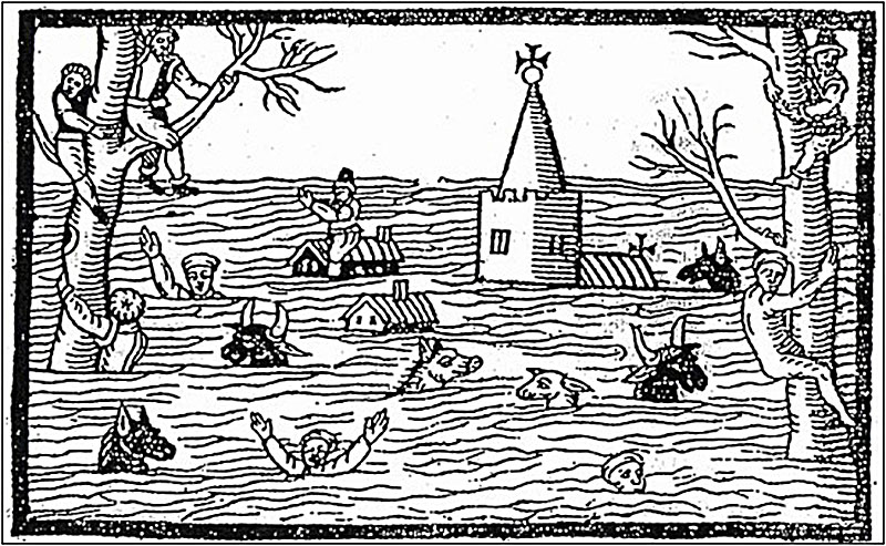
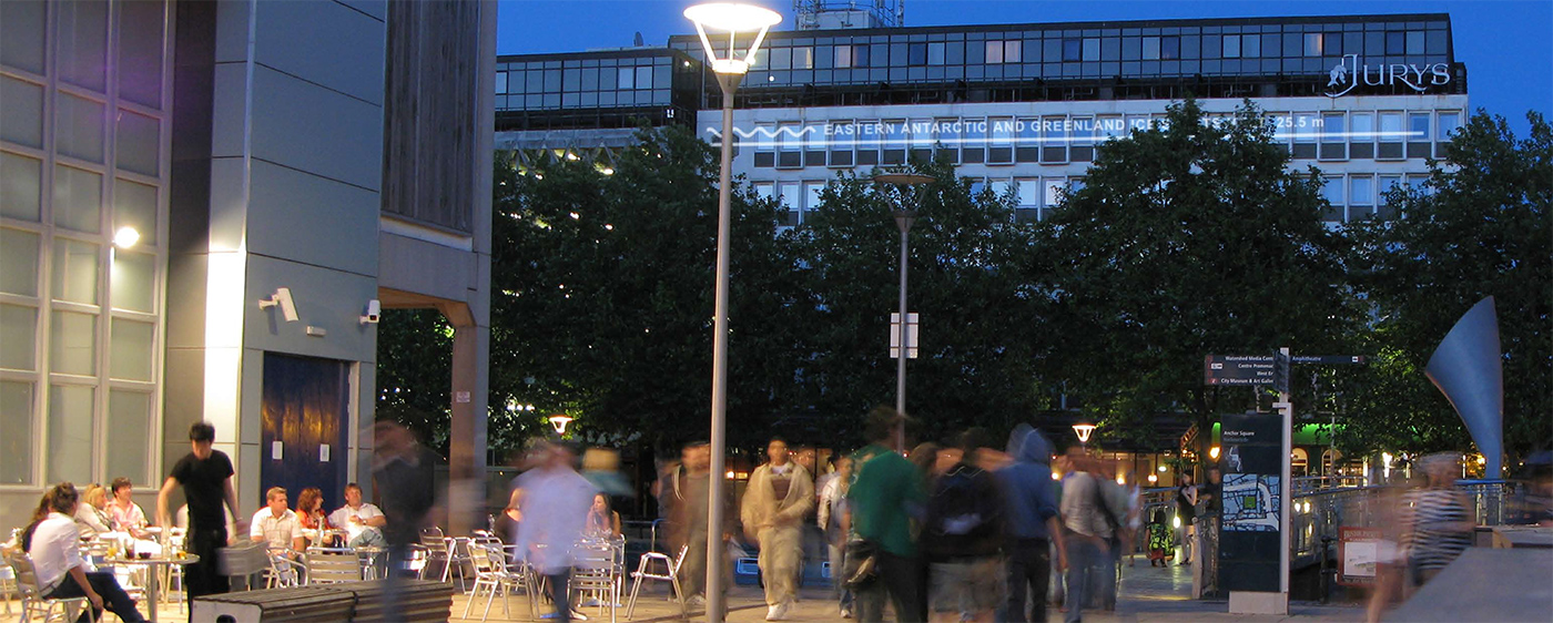
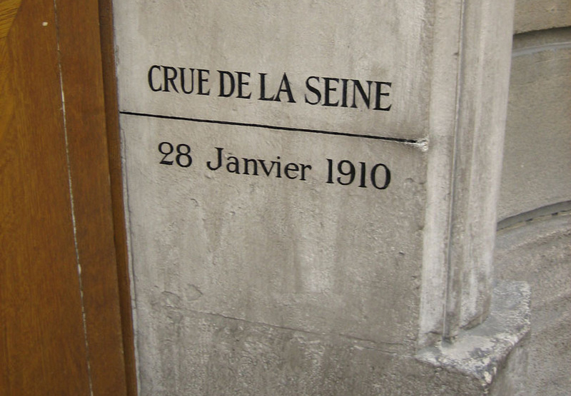
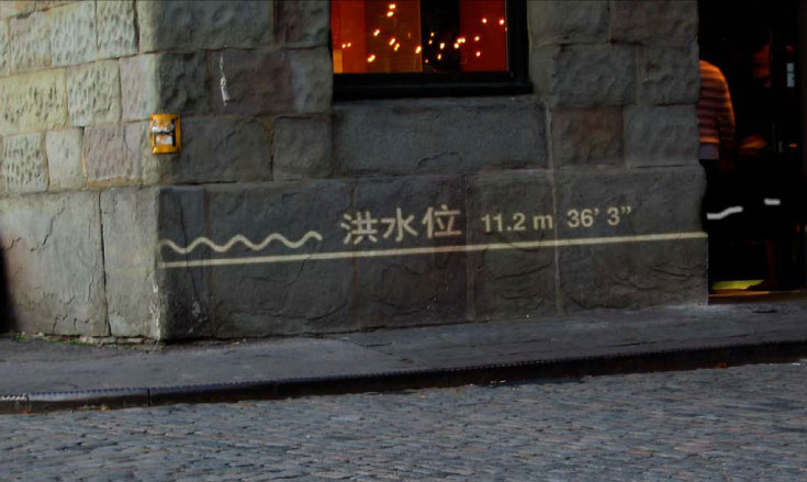
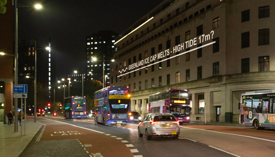
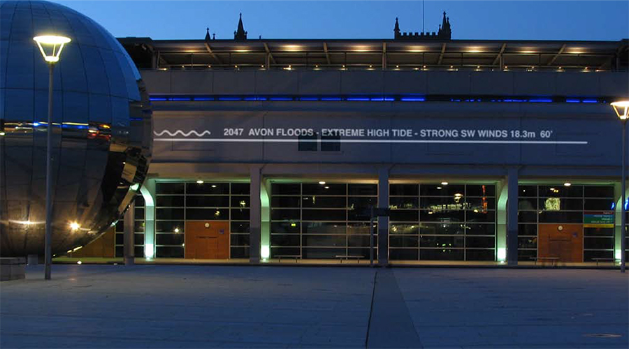
The high water levels of major flood events have been marked out on buildings, walls, bridges and other structures throughout history. This proposed project picks up on this tradition. However, instead of marking actual floods at the time they occur, it uses the same image system to ‘mark’ the position of possible future floods. It is proposed that, ‘flood marks’ would be projected onto the side of buildings, walls and other structures using digital projectors. The positions of the projected flood marks are intended to be accurate in terms of the topography of the city. That is, the level marked represents the actual level the flood waters would reach in a real flood event. As well as being specific and accurate in terms of their height/position, they would also be based on real scientific projections of possible future flood scenarios.
On a practical level, the use of projection allows the ‘marks’ to appear on any kind of surface, to be highly visible / luminous and to be displayed at height. This technique would necessitate projection from one side of a street (or other public space) to the other. Where traffic and passing people cut across the projected beams, fragments of text and strips of light would momentarily appear on clothing, skin and on the side of buses and cars. This dynamic relationship between the projected flood marks and the movement of people and vehicles through the city would strengthen the experience, piquing curiosity and allowing for a degree of interaction. Where the image is projected horizontally, at a low level, walking through the beam would become the equivalent of wading through the floodwaters.
It is conceived that the text accompanying each flood mark will be in multiple languages – each language being displayed for a time before being replaced by another. This not only reflects the multiplicity of languages spoken in the city but also the global nature of the phenomena described. The use of Bengali (Bangla), Mandarin Chinese and Dutch, for example, hint at how these countries would be affected.
The proposal aims to help an audience see, directly, possible future flood levels. This is intended to be a way of making some of the potential effects of climate change less abstract. To turn scientific data into a social cultural/experience that is played out in everyday, public places. Flood marks help us imagine the depth and extent of floods, to measure them against ourselves, to understand them in relation to the scale of our own bodies within familiar environments. We can see where the water level could come up to on a particular building and from this, imagine how these floods could affect other buildings, places and familiar objects, and consequently the impact they might have on our lives. It is hoped that by being accessible and by representing dramatic scenarios in familiar surroundings, these works would provide a catalyst for debate and discussion by a wide range of people.